Connecting the dots in our bike network
The importance of filling the gaps in our cycling networks.
In our towns and cities in Aotearoa New Zealand, There are areas in our cycling networks that have little to no cycling infrastructure installed between existing separated cycle routes, leading to a disconnection of our cycling networks between suburbs, employment centres and public transport hubs from our cycling networks. As a result, cycling in these parts can be unattractive, due to safety concerns. These gaps can range from big to small, but if these gaps are filled in, it would significantly improve the cycling environment in our city and connectivity to the wider cycleway networks.
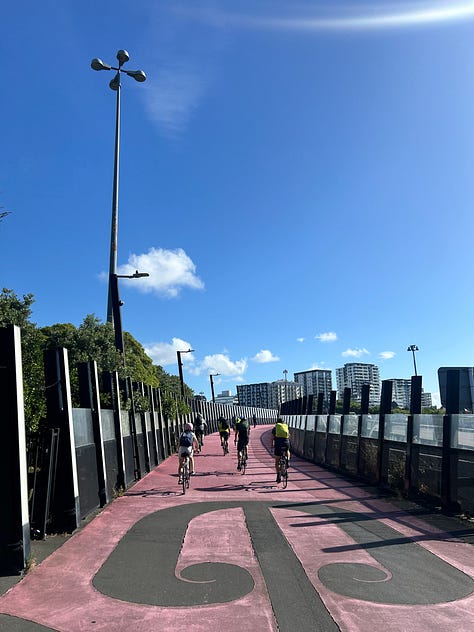
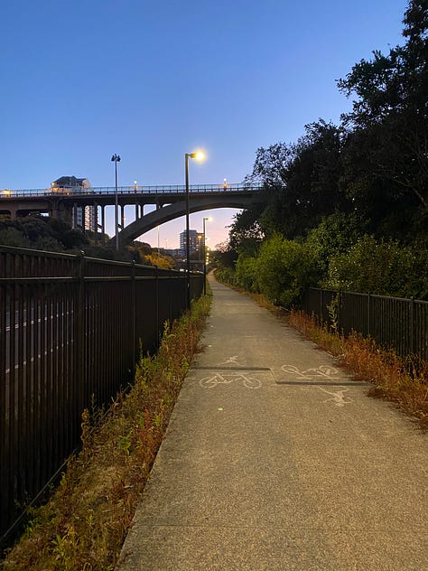
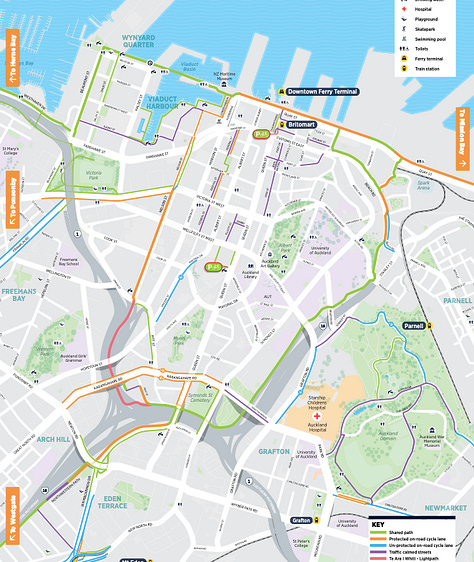
As our cycleway networks become more connected, we have seen an increase in our cycling numbers, known as the network effect. An example of this is the Northwestern Path in Tāmaki Makaurau Auckland, where annual cycling numbers have increased from 146,000 in 2013 to 322,000 cyclists in 2023. This increase came as connections into the city centre such as the Nelson St cycleway, The Lightpath and Grafton Gully which were built in the late 2010s to form the city centre bike loop, which connects onto the Northwestern Path to the west and Tāmaki Dr cycleway to the east. Also, through the completion of paths that connect onto the Northwestern Path (Eg: The Waterview Path which connects onto the New Lynn to Avondale Path and Southwestern Path).
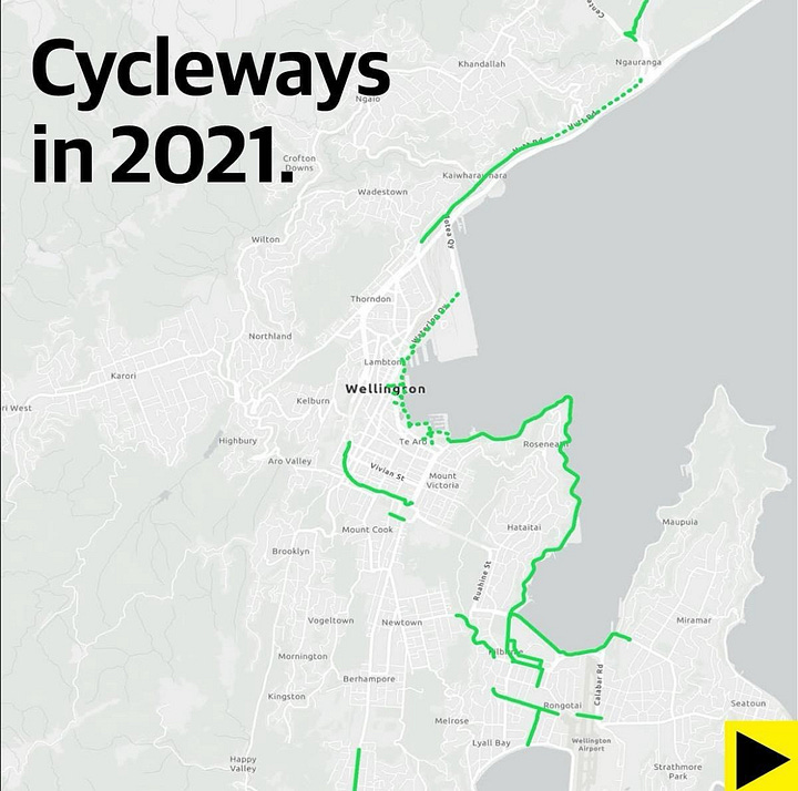
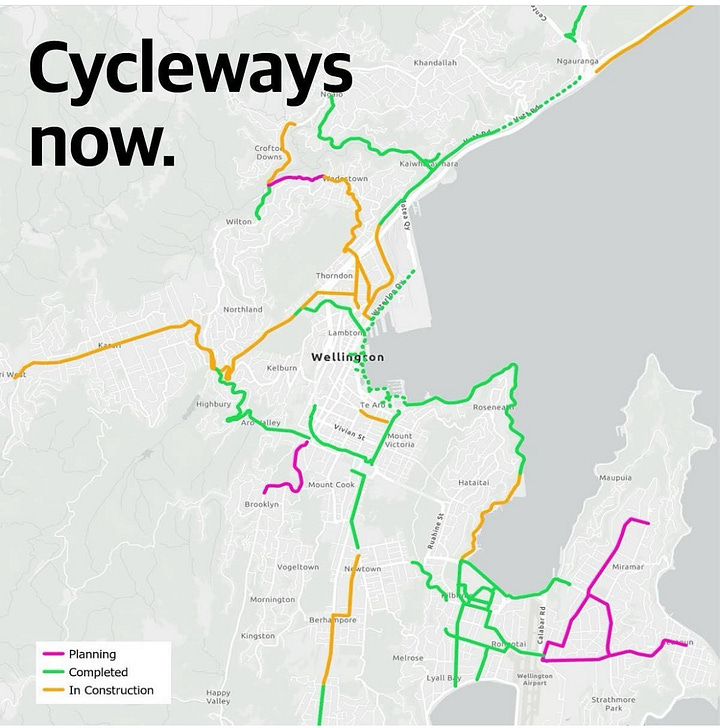
Another example of the network effects around Aotearoa is the Newtown to City cycleway in Te Whanganui-a-Tara Wellington, which resulted in cycling numbers increasing by 140% since 2022 as more cycling connections get delivered around the city. We have been the network effect in Ōtautahi Christchurch with the delivery of the Major Cycle Routes (MCR). Since 2017, cycling numbers have increased by 40% with several of the MCRs either fully or partly completed.
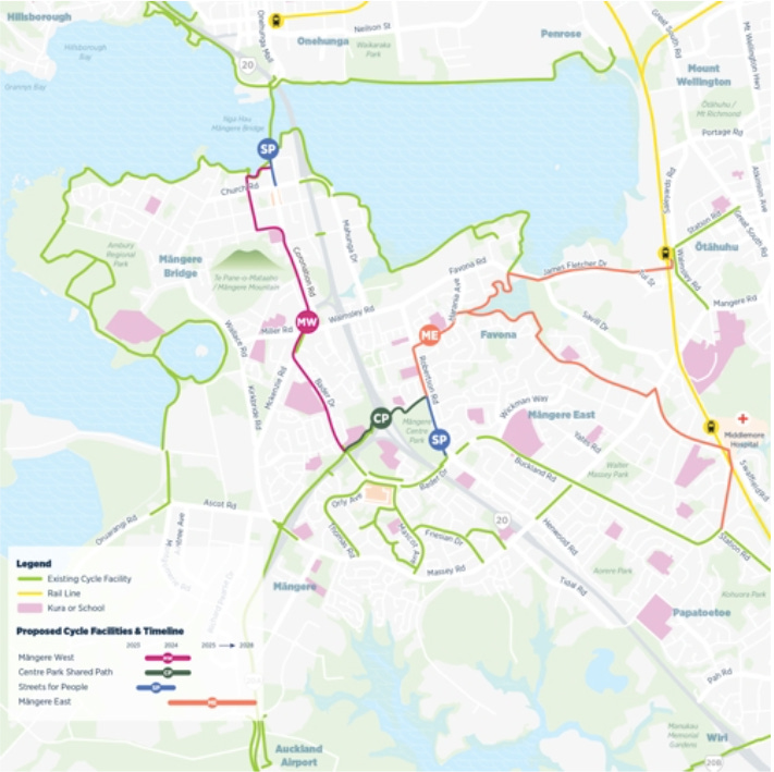
In Tāmaki Makaurau, There are projects recently completed and proposed to be under construction later this year to fill in gaps in the cycleway network. The first one is in Māngere Bridge, where a pop-up bidirectional cycleway has been installed on Coronation Rd as part of a Streets for People project by Auckland Transport and Waka Kotahi. This cycleway connects the town centre to the cycle path around Ambury Regional Park and to Ngā Hau Māngere, which opened in 2022. Which goes over to Onehunga and connects to the wider cycleway network with the Southwestern Path towards Mt Roskill and Mt Albert and Waikaraka Cycleway towards Sylvia Park.
There are proposals to join up the existing cycleways in the town centre to Ngā Hau Māngere and train stations in Ōtāhuhu and Middlemore with the Māngere West and East Cycleways, with the Māngere West projected to begin construction this year. However, The future of these projects is uncertain due to the ending of the Regional Fuel Tax and a reduction in funding allocated from the National Land Transport Fund for walking and cycling projects as proposed in the Draft Government Policy Statement of Land Transport 2024-2034. The Māngere West cycleway has been identified as a key project in the Draft Regional Land Transport Plan 2024 - 2034, which is currently out for public consultation.
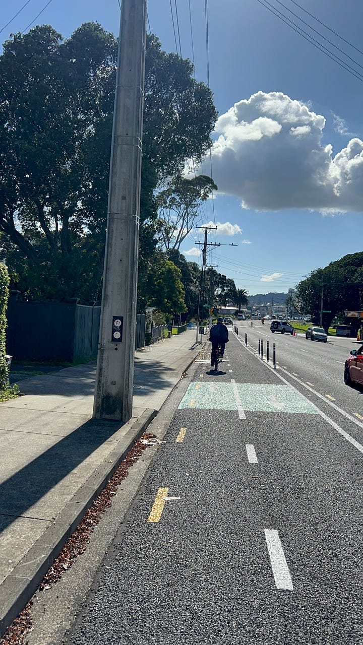
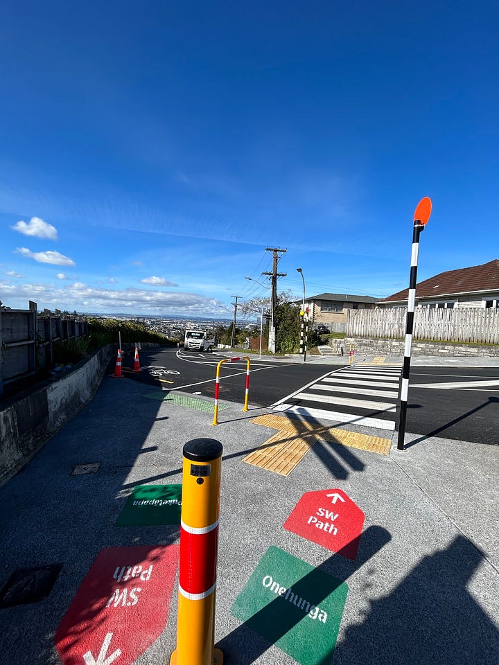
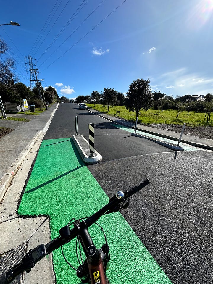
We go west to Hendry Ave, where upgrades were completed last year as part of the Transport Choices package to improve the safety for cyclists with traffic calming by installing speed bumps with bypasses for cyclists, raised crossings and lower speed limits. This upgrade fills a gap in the Southwestern Path between Mt Roskill and Onehunga.
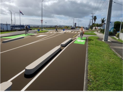
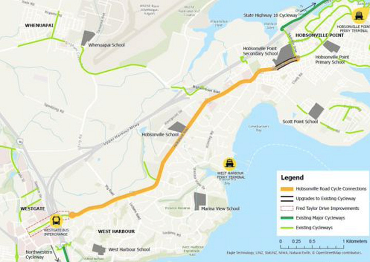
We head to the northwest of the proposed cycleway on Hobsonville Rd, which is expected to begin in late 2024. This cycleway will create a cycling connection from Hobsonville Point, West Harbour to Westgate with schools, supermarkets and other amenities along the corridor. The cycleway will connect into the Upper Harbour Cycleway, shared paths and cycleways built as part of large-scale developments in Hobsonville Point and Scott Point and The Northwestern Path at Westgate, with schools, supermarkets and other amenities along the corridor. This cycleway will help unlock more multimodal trips to catch the WX1 bus at Westgate and ferries at West Harbour and Hobsonville Point.
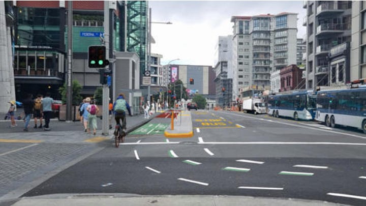
A gap proposed to be filled through the use of tactical urbanism is on Victoria St between Federal and Nelson St, which is currently open for consultation. This bi-directional cycleway will act as an interim solution till a permanent solution is installed as part of Te Hā Noa, extending the existing cycleway on Victoria St (between Nelson and Beaumont St) to the cycleway that is currently under construction as part of Te Hā Noa (between Kitchener and Federal St). This will connect to Nelson St, Waihorotiu Path on Queen St and Franklin Rd. This will create another east-west link across the city centre from Victoria Park to Albert Park. This extension is to be installed in July.
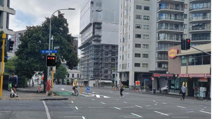
It’s good to see these additions to the cycleway network in Tāmaki Makaurau. There are still gaps throughout the city that need to be filled to continue unlocking more of the network effect.
Glen Innes to Panmure Station:
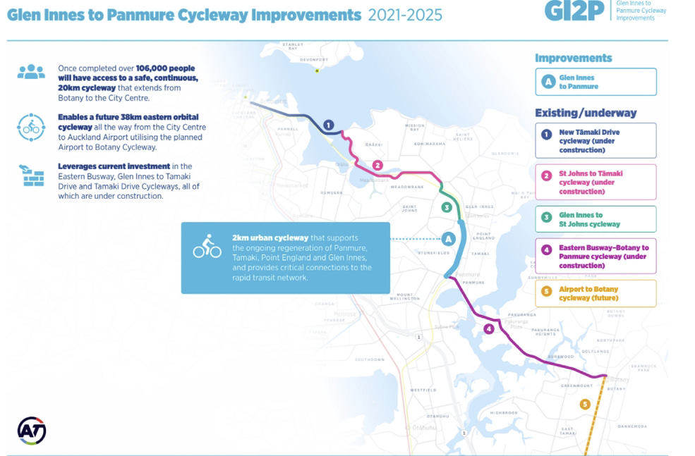
The first gap I’ll be discussing is between Glen Innes Station and Panmure Station. Filling this gap by putting infrastructure on either Merrin or Pilkington Rd can unlock the network effect for East Auckland by connecting Te Ara ki Uta ki Tai at Glen Innes and the cycleways currently partly completed and under construction from Panmure Station to Botany as part of Eastern Busway. Prioritising the delivery of this cycling link was mentioned in 2021 when funding from the former Northern Pathway project was reallocated to Eastern Busway.
Connecting these two cycleways will result in a safe, separated cycle route from Botany to the city centre. This also will unlock multimodal trips to Glen Innes and Panmure Station, supporting homes being built in Stonefields and being built at Glen Innes and Panmure as part of the Tāmaki Regeneration project.
Albany Highway between Upper Harbour Dr and SH18 Shared Path:
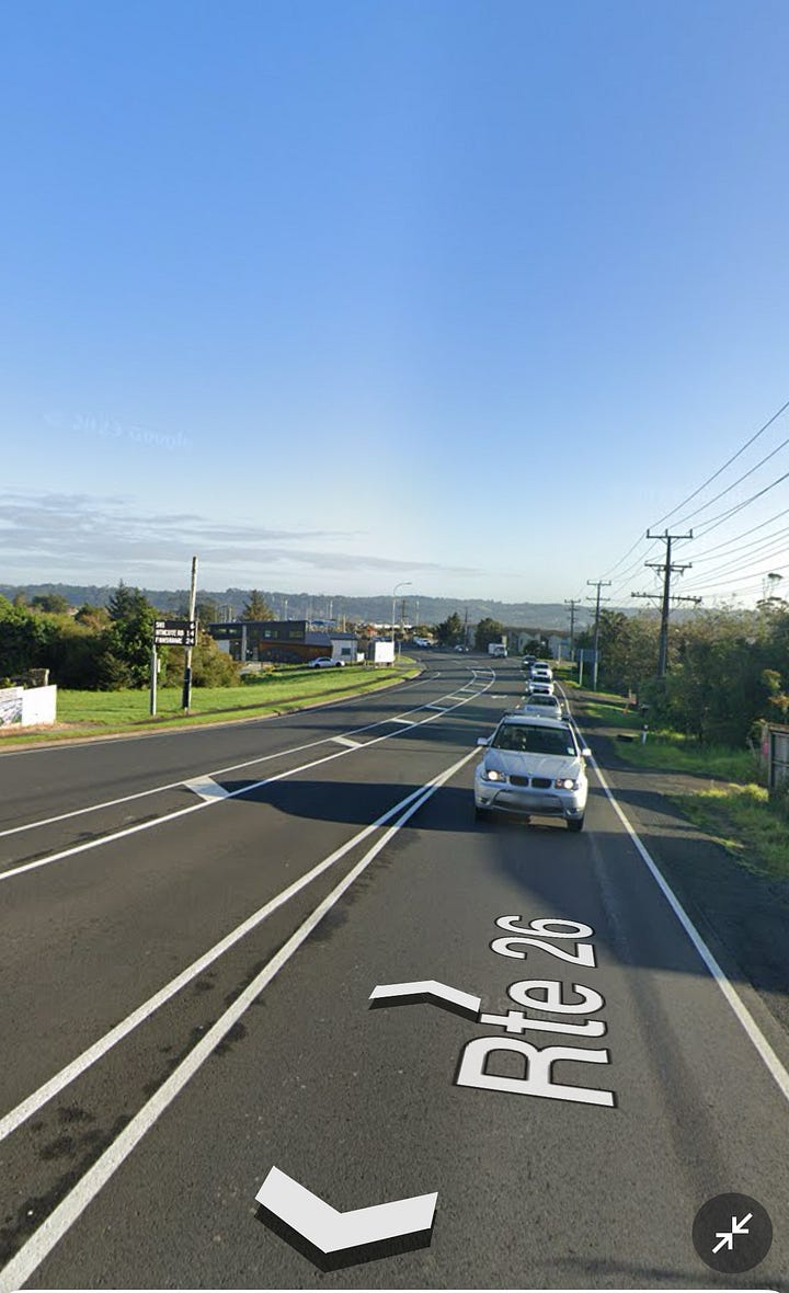
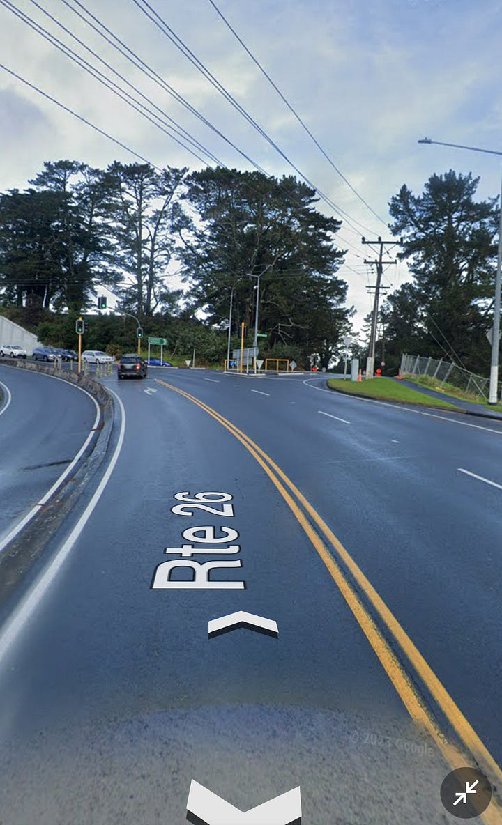
This small gap in Albany Highway needs addressing to improve the safety for cyclists, as the cycling environment feels unsafe due to the high traffic volumes, especially when crossing the road to get into Upper Harbour Dr when heading towards Greenhithe. Existing cycling protection is poor with only narrow painted cycle lanes around the SH18 exits. This part of the Albany Highway is on a major cycle route from West Auckland to North Shore, connecting Hobsonville Point, Greenhithe, Rosedale, Constellation Station and Albany.
Grey Lynn to Westmere (Waitematā Safe Routes):
Delivering the Waitematā Safe Routes will fill a gap that will be created when two cycleway projects currently under construction on Point Chevalier and Meola Rd as part of Point Chevalier to Westmere Improvements and on Great North Road (GNR) are completed.
Connecting these two cycleways and to greenways that go through Grey Lynn will enable safer journeys to local schools, shops and Western Springs. It will also create a fully connected cycle network in the inner west, as it will be connected to the wider cycleway network with GNR connected onto Karangahape Road and The Lightpath to create a safe cycling route to the city centre. The cycleway on Point Chevalier Rd will be connected to the Northwestern Path, the nearby Waterview Path and planned cycleways on Carrington Rd as part of the Carrington Rd improvements to West Auckland, Mt Albert, Mt Roskill, and Onehunga.
The project was put on hold in early 2023 due to budget constraints. Auckland Transport has identified Waitematā Safe Routes as a key project in the Draft Regional Land Transport Plan 2024 - 2034.
Auckland Harbour Bridge:
The most notable gap in the cycling network in Tāmaki Makaurau is between the city centre and the North Shore. Having the ability to bike over Te Waitematā on the Harbour Bridge will unlock more transport choices for those to live on the North Shore, with connections to existing infrastructure like the Northcote Safe Routes, which will support growth with new homes built in the Northcote Development. There is also potential to see the Northern Pathway extended to Akoranga alongside the Northern Motorway corridor, with cycling connections into the city centre from Westhaven, it will create a safe separated route from the city centre to Albany with connections to the SH18 shared path to Rosedale.
In conclusion, if we want to unlock the full potential of cycling to incentivise mode shift, reduce our emissions and vehicle kilometres travelled, we need to create a fully connected network in our towns and cities. Having a fully connected cycle network creates safer streets for our kids to travel to and from school, to travel to work and major amenities and for the first and last leg of people’s journey to public transport stations to create multimodal journeys. Ultimately, it will enable a safer, accessible and sustainable transport network.


Thanks Shaun .
I wonder are there plans to provide secure ,undercover and safe lock up spaces for bicycles at the domestic and international airport . ? To cycle from Waterview to the airports and leave a bicycle there for a period of time would be great . 🤞