

Shaping transport outcomes of large scale housing developments
Shaping transport outcomes of large scale housing developments
What has being done well and what needs improving in relation to transport intergration with Tāmaki Makaurau's large scale housing developments.

In a housing crisis, we need to pull the biggest lever to increase supply through building more homes. One of the ways this is being delivered in Tāmaki Makaurau Auckland is through large-scale housing developments led by Kāinga Ora. These developments, which are partly underway are delivering thousands of new state, affordable and market homes to neighbourhoods across the city over 20 years. Public realm improvements and major infrastructure investments to support these growing neighbourhoods are also being completed as part of these developments.
This article will focus on large-scale brownfield developments located in Māngere, Roskill, and Northcote, on what these developments are doing well and what needs improving about how they integrate with the transport network.
What’s being done well:
One area that’s been done well is walking and cycling within the neighbourhood developments, where multiple greenways and shared paths have been built in the Northcote and Roskill developments. In Northcote, Te Awa Awataha is a greenway that connects the neighbourhood with the town centre, schools, playgrounds and recreational areas. As part of the upgrades to Freeland Reserve in the Roskill South neighbourhood, new pathways were built to improve walking and cycling connections in the neighbourhood to local schools. In the Ōwariaka neighbourhood, a greenway is nearly completed to improve connections to local schools as part of upgrades to Sir Murray Halberg Park.


The paths and greenways in the Roskill South and Ōwariaka neighbourhoods connect onto the wider cycling networks with the Southwestern Path and Te Auaunga Oakley Creek, creating safer walking and cycling connections to shops on Stoddard Rd, Unitec, recreational areas and Onehunga. In Northcote, Te Awa Awataha connects to the Northcote Safe Cycle Route on Lake Rd, connecting the suburb by bike to the employment centres and busway station at Smales Farm and North Shore Hospital. Throughout all of these neighbourhoods, wider footpaths, accessibility improvements and raised crossings have also been constructed to improve pedestrian safety, accessibility and walkability.


In Māngere, there are plans to improve the walking and cycling environment in these developments by creating a separated cycleway network with a series of cycleways and shared paths, joining up with existing cycleways in the town centre. The Māngere West cycleway was due to start construction this year. However, the future of these cycleway projects is uncertain following the loss of funding due to the central government ending the Regional Fuel Tax.
These pathways discussed above will enable more walking and cycling trips to local schools, local town centres, employment centres, and public transport interchanges. Improving these developments' walking and cycling links can help reduce vehicle kilometres travelled (VKT). Particularly, short-distance car trips which make up 1/3 of car trips in Aotearoa and can be easily replaced by foot, bike or scooter.
Improving the walking and cycling environments in these neighbourhoods aligns with the goals and outcomes discussed in Kāinga Ora’s Sustainable Transport Strategy. The strategy explains the strategic transport outcomes that Kāinga Ora wants to achieve for their large-scale projects. The goals that align the most with the walking and cycling improvements in Northcote and Roskill development are creating wider connections and access to recreational open spaces and natural environments, as they connect to the wider cycleway network, playgrounds, parks and recreational areas and are integrated into green spaces.

What needs improvements:
What needs improving with the development is integration with the public transport network. While acknowledging that public transport planning is outside the responsibility of Kāinga Ora, improvements to the public transport network are needed to support these communities as they grow.
Public transport services from Northcote to the Northern Busway stations at Akoranga and Smales Farm are infrequent, being served by connector routes, running every 30 minutes, 7 am - 7 pm.
In Māngere, the area is serviced by frequent buses to Onehunga, Ōtāhuhu, Papatoetoe, Manukau and Auckland Airport precinct. However, the suburb has poor connectivity to the wider public transport network, resulting in slow journey times. E.g.: Journey times to the city centre range from 55 minutes (bus with transfer to train at Papatoetoe) to 1 hour and 15 mins (by the 309).
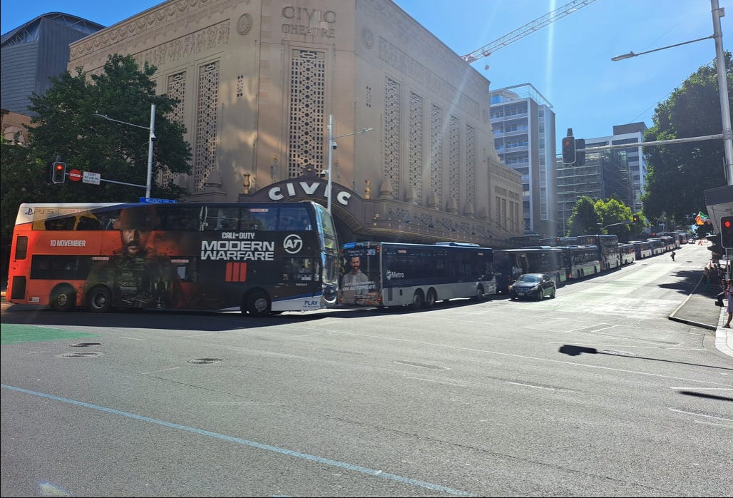
The neighbourhoods in the Roskill development are serviced by frequent buses (24 and 25) by Sandringham and Dominion Rd. However, these routes are close to capacity, causing bus congestion in the city centre, which is affecting bus service reliability.
During the previous Labour government, the main plans to improve capacity and public transport connections to the city centre were the Auckland Light Rail project from the city centre to Māngere via Mt Roskill and the Waitematā Harbour Connections project, which included plans to extend the Northern Busway from Akoranga to the city centre by reallocating road space on the Auckland Harbour Bridge and for light rail to add more capacity. However, following the election of the current National-led government last year. The light rail project was cancelled and light rail is now unlikely to be part of the Waitematā Harbour Connections project.
Following this, there are no long-term plans to improve the public transport connections to support these developments as they grow. If no improvements are made to public transport, these neighbourhoods will likely become car-dependent.
There are plans to improve the public transport network over the next few years to bus services servicing the Northcote and Roskill developments to deliver frequent connections to major public transport interchanges, employment and town centres.
Proposed improvements are:
The 942 will be upgraded to the 94, which will see a frequent bus connection from Northcote to Akoranga Station, Takapuna and Birkenhead, These are expected to be live by 2027.
The 670 will be upgraded to the 67, which will see a frequent bus connection from the Ōwariaka neighbourhood to New Lynn, Avondale, shops on Stoddard Rd, Onehunga and Ōtāhuhu. This is expected to go live in 2025.
Additional services will be added to the 24 and 25 in the peak and evenings. These are expected to go live in 2025.
In the Regional Land Transport Plan 2021 - 2031, $62 million was allocated for enhancements to the Northern Busway.
These enhancements consist of:
Signal phasing optimisation and bus stop extensions on Fanshawe St to improve reliability.
Minor bus priority on SH1.
Upgrades to busway stations including platform extensions and bus circulation changes.
These enhancements are expected to be implemented around 2028 - 2029.
It’s great to see these improvements planned. However, the biggest challenge facing the delivery of these improvements is securing opex funding, as funding is proposed to be reduced in the Draft Government Policy Statement (GPS) on Land Transport.
Improvements that could be made in the short term to improve public transport at Māngere include more express buses running throughout the day to deliver faster journeys and better connections to and from the city centre and also, strengthening bus routes to and from nearby train stations through interventions like bus priority to improve reliability.
Regarding long-term planning. Despite the cancellation of the previous governments tunnelled light rail project, it does not mean that light rail is off the cards by having light rail running on the surface instead in any future public transport plans or as part of a city deal between Auckland Council and the central government. Surface running light rail is a more affordable and accessible alternative to delivering light rail to increase capacity and improve public connections from the city centre to Māngere and the North Shore.
Light rail will enable opportunities for housing and transit-oriented development (TOD) along the corridor thanks to local and central government policies like the National Policy Statement for Urban Development (NPS- UD). Light rail will help reduce bus congestion in the city centre, which will open up capacity for other bus services going to areas all around Tāmaki Makaurau, making it easier to implement plans and strategies focusing on improving public transport in the city centre (eg: The City Centre Bus Plan).
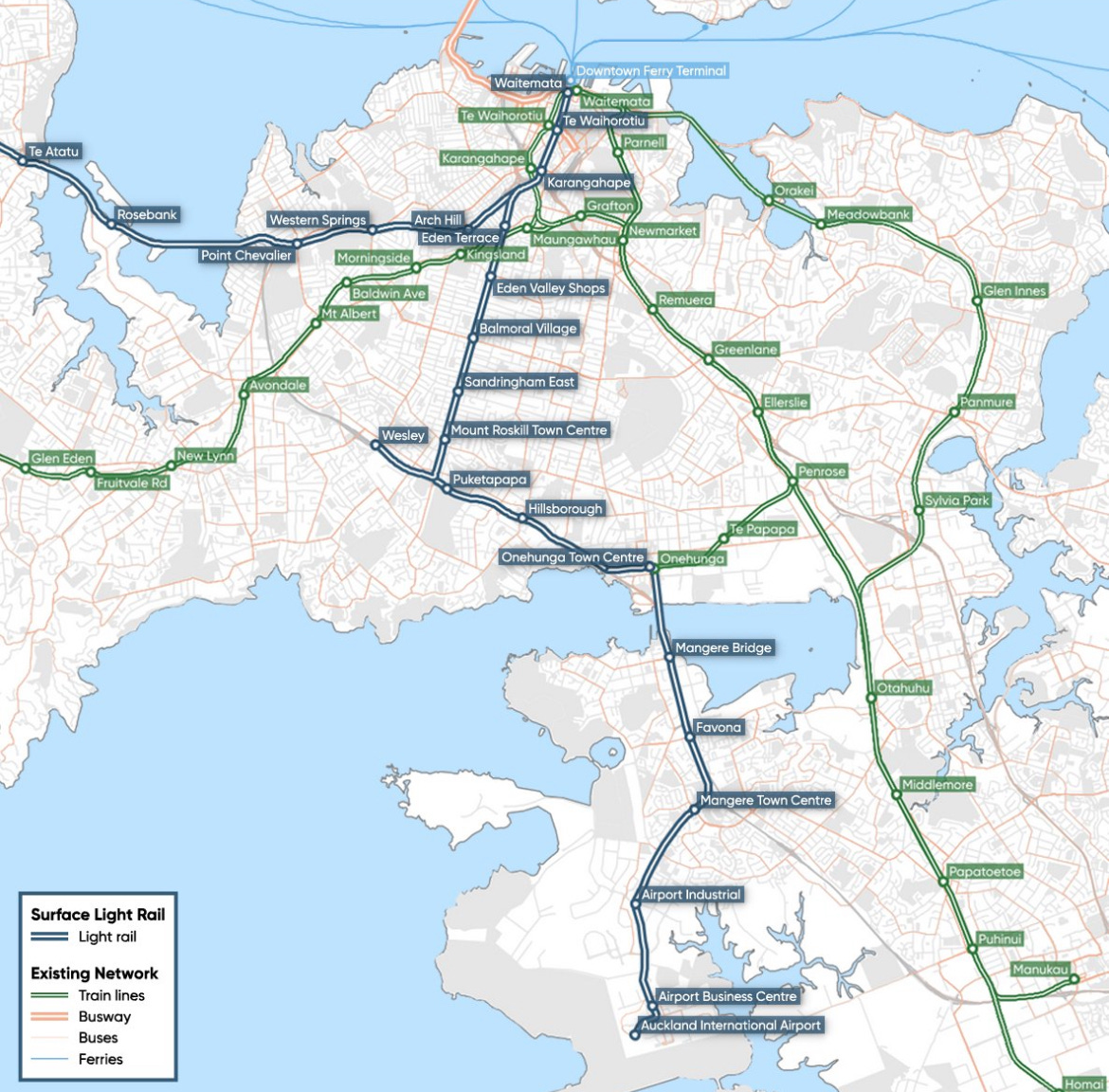
Long-term planning is needed for the North Shore with the Northern Busway expected to reach capacity by the mid- 2030’s. In the North Shore Rapid Transit Study which was undertaken in 2016, the study identified that light rail is the most feasible mode to futureproof the rapid transit connection to North Shore.
Light rail to the North Shore could be delivered by either converting the Northern Busway corridor or by another route by a bridge or tunnel over the Waitematā. Light rail to the North Shore could easily be integrated with the above proposal for light rail from the city centre to Māngere to create a north-south transport corridor. The Auckland Rapid Transit Pathway, released last year by Auckland Transport, identified light rail as the preferred mode of rapid transit for both the North Shore and the City Centre to Māngere corridors.
Challenges:
The biggest challenges facing achieving Kāinga Ora’s sustainable transport outcomes are budget constraints and decision-making from local and central government agencies outside of Kāinga Ora.
Recent decisions such as the cancellation of the Regional Fuel Tax are examples of decisions that misalign with sustainable transport outcomes, as they could lead to the cancellation of public and active transport projects throughout Tāmaki Makaurau. This includes projects to improve public transport access and walking and cycling connections to these developments (Eg: Māngere West cycleway). The budget for public transport and active modes is proposed to be reduced in the Draft GPS on Land Statement 2024 - 2034 released earlier this month. This means less funding will be available from central government to local councils, who are experiencing budget constraints themselves to develop and build these projects and deliver more services on the public transport network.
There are potential improvements to public transport and active modes that can be delivered at a lower cost to solve the challenges around budget constraints. An example is using methods like tactical urbanism to deliver walking and cycling improvements at a cheaper and faster rate. This is shown in Te Whanganui - a- Tara Wellington, which has used tactical urbanism methods to deliver its cycleway network.
Conclusion:
It's good to see the improvements made to active modes connections to enable safer and connected journeys to local schools and amenities within the proximity of these developments and it is great to see them well connected with nature and open spaces through the use of greenways.
However, significant gaps need to be filled to achieve good outcomes for these communities by ensuring that these developments are well-integrated with the public transport network. Not only to enable mode shift to reduce car dependency and emissions but to help build and shape more vibrant and sustainable urban environments for current and future residents of these developments to enjoy and thrive in.
Kia ora Shaun! At an LGNZ hui, I asked Minister Bishop whether subdivisions and density enbaled by the FTC bill and proposed RMA amendments would come with solid commitment from govt re school growth (MOE), PT and road safety improvements (WK co-funding). For me that's because these have been business cased endlessly in Selwyn before and since NPS-UD plan change extravaganza, only to have everything paused, reviewed or cancelled - but the homes are still on track, thousands of them. His answer was clear in its understanding that communities are more than just dwellings.. but still light on making the aspects that lie within central govt's remint happen. Yay.