

How land use policy doubles as climate policy: Part 1
How land use policy doubles as climate policy: Part 1
How land use planning play a significant role in emissions reduction and climate adapation in our cities.

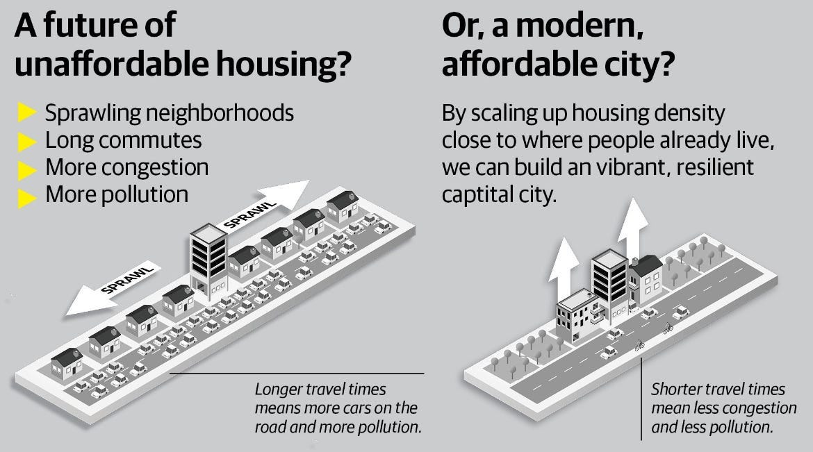
Urban growth is a major challenge facing our towns and cities in Aotearoa New Zealand.
Our cities are growing with the population of Tāmaki Makaurau Auckland increasing by 5.9% between 2018 and 2023 according to recent census data. Our urban centres are projected to grow with Tāmaki Makaurau projected to keep growing by 37% by 2048. On top of that, there is a need to increase housing supply to keep up with current demand, improve housing affordability and shape our cities to help achieve our emission reduction targets and be more resilient to our changing climate.
Urban form plays a significant role in how our cities operate and our quality of life. Where we live affects our access to transport, amenities, health, education and employment. Also, the risk of properties to major flooding events and sea level rise could result in severe damage to properties and infrastructure and areas being inhabitable.
In this two-part piece, We’ll be looking at how land use policy plays a role in reducing our emissions and climate adaptation in our cities.
How land use policy can play a role in reducing our transport emissions:
We start by talking about how land use policy can help us reduce our transport emissions, which significantly contribute to the emissions profile in our cities in Aotearoa, with transport making up 43.6% of total emissions in Tāmaki Makaurau, our land use must be integrated into our transport network. In Te Tāruke-a-Tāwhiri: Tāmaki Makaurau’s climate action plan, There are targets to reduce our transport emissions by 64% by 2030. To help achieve this target, The Transport Emissions Reduction Pathway (TERP) was developed, which contains targets for mode shift to increase public transport trips to 550 million, increase cycling mode share to 13% and reduce vehicle kilometres travelled (VKT) by 50% by 2030.
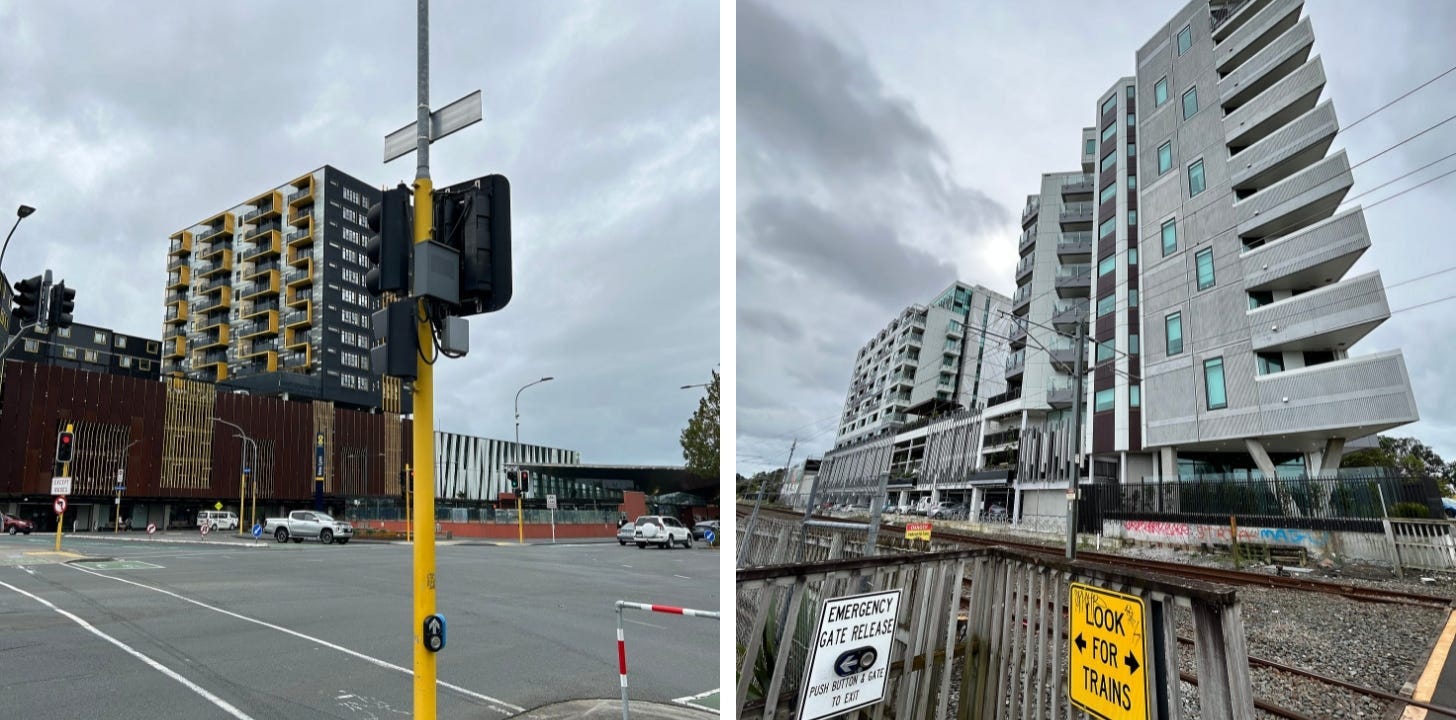
Historically, the urban form of our urban centres has been shaped around transport corridors with the rise of “streetcar suburbs” which saw development around the former tram and streetcar networks in the early to the mid-20th century. As we saw the rise of the automobile following the end of World War 2, we saw our cities sprawling out as motorways were built, as we saw a significant decline in public transport services and a poor walking and cycling environment. The people who call these suburbs home were locked into one transport option: the car.
Planning our future growth around public transport corridors and town centres started in the 2010s with the Auckland Unitary Plan (AUP) in Tāmaki Makaurau, which saw upzoning to allow for apartments and townhouses around some town centres, train stations and public transport corridors. In 2020, The National Policy Statement of Urban Development (NPS-UD) was released, which requires Tier 1 councils to upzone for higher-density housing around train stations and town centres. Enabling more density around our train stations and existing town centres helps support the mode shift to public transport and active modes. More homes built within walking distance of existing amenities and employment centres can reduce VKT by replacing short-distance car trips with walking or cycling.
Focusing on brownfield development enables more homes close to existing public transport corridors, where frequent public transport services are already on their door and some transport infrastructure is already in place. The findings of the VKT reduction programme for Tāmaki Makaurau which was released in April this year. It identified that encouraging more development in suburbs in the city centre and minimising greenfield development in peri-urban areas can contribute to reducing emissions.
Greenfield developments require major infrastructure spending to support the population growth in these areas. However, transport authorities cannot keep up with the number of private plan changes being lodged and processed by councils and are experiencing budget constraints. Which affects their ability to deliver infrastructure and public transport services to these subdivisions. Because of this, not all of these new subdivisions are accessible by public transport and if they are, the service is infrequent with a 30-minute or hourly bus service. Some of these subdivisions have cycling infrastructure with shared paths and protected cycle lanes included in the master planning of these developments. However, they’re disconnected from the wider network, making journeys by bike unattractive due to safety concerns, as I have discussed in my previous article. As a result, these subdivisions are largely car-dependent.
To explain how enabling brownfield development in our inner city suburbs and around rapid transit stations instead of greenfield development can help towards incentivizing mode shift and reduce VKT, I’ll be using this hypothetical example:
Two people commute to their workplace at Wynyard Quarter, arriving at 8:45 am.
Person A lives in Huapai:
Car: via Northwestern Motorway ranging from 50 min to 1hr 50m (will need to leave Huapai at 6:55 am) or 45m to 1hr 30 min via SH18 and SH1 (leave at 7:15 am).
Public Transport: 1 hr 45m (11 min walk to St Patrick's Church to catch the 125 (runs every 30 mins) at 7:03 + transfer to the WX1 at Westgate + transfer to the 75 at Wellesley St).
Bike: 1 hr 54m (via Nixon/Red Hills Rd, which has no cycling protection when on the Northwestern Path from Westgate, mostly protected).
Person B lives in Kingsland:
Car: ranging from 12 to 28 mins via Scanlen St and Franklin Rd.
Public Transport: 35 mins (3 min walk to New North Rd to catch the 20 (runs every 15 mins at 8:04 am).
Bike: 22 mins via the Northwestern Path, mostly protected.
This shows the benefits that enabling more density close to the city centre, town centres and train stations can deliver to our transport network through shorter commute trips, great access to frequent public transport and travel times on public transport completive and in some cases, faster journey times than car. This makes the mode shift to public transport and active modes more attractive, which will help reduce car congestion, air pollution and our transport emissions.
It’s important to acknowledge that more infrastructure is needed to achieve a greater reduction in VKT, as findings in the Tāmaki Makaurau’s VKT reduction programme found that if land use changes but no changes to infrastructure, VKT will only be reduced by 6.8% by 2036. Our arterial roads need to be redesigned by allocating road space for cycling to create a safe and connected cycling network and bus priority to improve the reliability of buses. We also need to deliver more rapid transit in our main centres. By integrating these improvements with a dense urban form, it can significantly reduce transport emissions, air pollution and car congestion.
The NPS-UD and the Medium Density Residential Standards (MDRS) could benefit from changes to enable mixed-use development to create more amenities (eg: a supermarket, cafe and retail) within walking distance or below people’s homes and transit-oriented development (TOD) around public transport stations. The findings of Tāmaki Makaurau’s VKT reduction programme recommended changing the AUP to make some mixed-use activities a permitted activity within areas zoned Terrace Housing and Apartment Building (THAB). I have previously discussed how enabling mixed-use development can help reduce VKT in this article I wrote last year.
The National Party (part of the current government) had signalled they wanted to amend the NPS-UD to enable mixed-use development in their Going for Housing Growth policy document that they released as part of their 2023 election campaign. In the same policy document, they proposed changes to how infrastructure in greenfield developments is funded, by removing subsidies to fund infrastructure and having infrastructure funded by targeted rates and levies instead. This can help incentivise future growth to be developed in brownfields instead of in greenfields and reduce infrastructure costs for councils.
Overall, land use and transport go together, ensuring that our land use is well-integrated with our transport network, will help to enable more sustainable living with more people having easier access to public transport and major amenities by walk, bike or scooter to help achieve mode shift and achieve our emission reduction targets.
This concludes Part 1. Stay tuned for Part 2, where we will be covering how land use policy plays a role in creating a resilient city from natural hazards.